In late 2006, a team from the University of Washington visited the WAIS Divide field camp in West Antarctica to investigate the distribution of annual-scale layers upstream of the WAIS Divide ice coring site. This upstream area is of considerable importance for the WAIS Divide ice core because this is where all of the ice found in the ice core originally fell as snow. For example, an ice sample from a depth of 900 m started approximately 5 km upstream of the present ice coring location and traveled downstream over the next three thousand years. If there are large variations in the rate of snowfall in the upstream area, or if the snowfall rate varies in time with a spatially coherent pattern, the climate signal from the ice core will show climate-like signals that may not be caused by global climate variations.
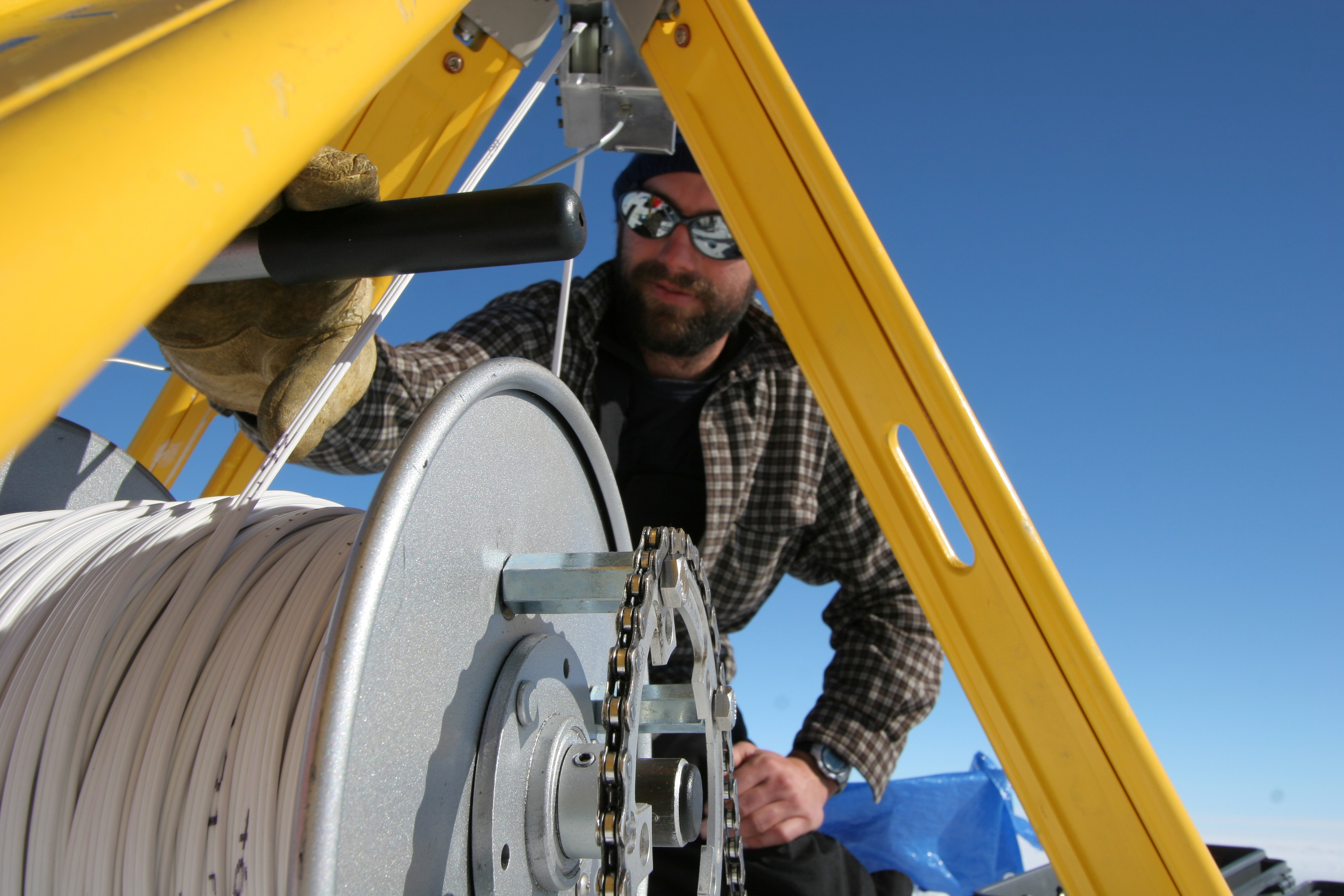
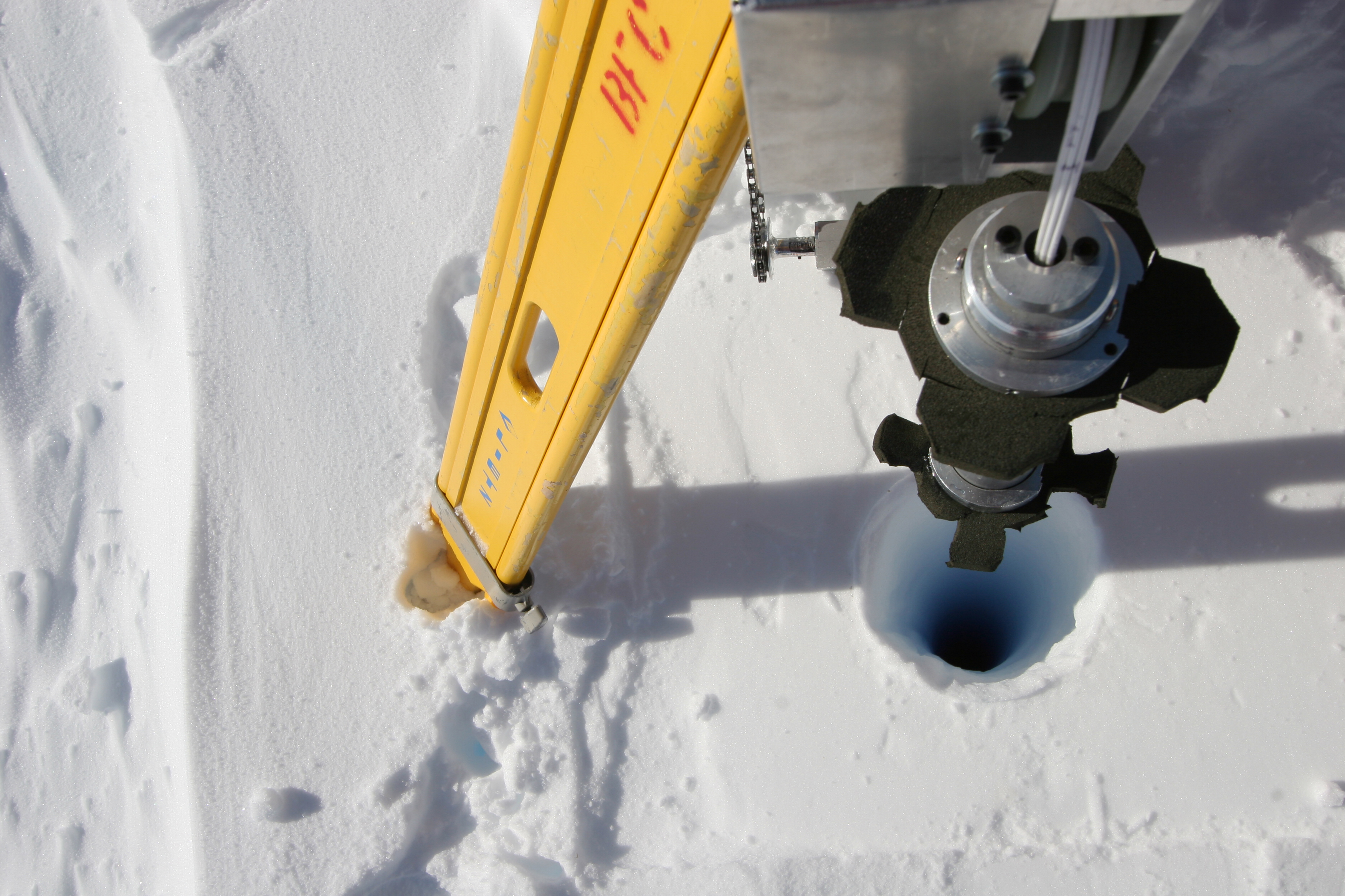
The field party used a combination of ground-penetrating radar and a borehole camera to look at variations in accumulation patterns in the 6 km immediately upstream of the ice-core site. The radar measures the depths to a few layers in the top 50 to 100 meters of the firn. These depths can be converted into an estimate of accumulation rates over the past 200 years, although, because only a few different layers are present in the records, these data can show only changes in accumulation over a few decades. In the same area, the field team drilled an array of fourteen boreholes to a depth of 15 meters. In each of these boreholes, they lowered a camera with a light source, and recorded video as the camera traveled up and down the borehole. These videos give a record of the reflectance of the borehole wall as a function of depth. Melt layers, hoar-frost layers, and wind crusts all leave signatures in the firn that show up as fluctuations in the brightness of the borehole wall, allowing us to use these records as “virtual ice cores.” By identifying patterns of layers that appear in different cores, we can calculate how accumulation varied on a 1 year to 2 year time-scale over the last 20 to 30 years.
Preliminary analysis shows that, in the undisturbed upstream region of the WAIS Divide ice coring site, the accumulation rate varies by around 3% to 5%, with a wavelength greater than the extent of our grid. The strongest variations occur in the upwind direction; across-wind variations are on the order of half as large. The layering patterns appear to reflect spatially fixed accumulation variations, presumably driven by subtle undulations in the snow surface. Interestingly enough, in the 500 meters upwind of the eight-meter-high arch-shaped building now housing the WAIS Divide ice-core drill, the near-surface layers are strongly disturbed due to the arch structure: There is an area of wind scour within a few hundred meters of the arch where the accumulation rate is cut in half, and an area of high accumulation directly at the arch where the accumulation increases by a factor of around three. The impact of the building shows that deposition and erosion of blowing snow is very sensitive to variations in surface height.
The borehole data show a variety of small features that we can identify between boreholes up to 3 km apart, but overall, the background layering pattern is substantially different from borehole to borehole. This suggests that, while storms impact the whole region, most spatial variability in firn characteristics is driven by local processes such as random snow drifting shortly after deposition. The depths of features that correlate between boreholes vary by 10 to 20 cm from hole to hole, which is approximately the scale of surface drifts and sastrugi at the WAIS Divide site today. In most of the boreholes, there does not appear to be a strong annual-layering signal as has been seen with the downhole camera at Summit, Greenland and at Siple Dome, West Antarctica. However, in the four deeper boreholes, the annual signal becomes cleaner as the firn becomes denser, and those holes show brightness variations that match the expected annual signal at WAIS Divide.
Further analysis of the borehole and radar data will result in a map of accumulation in the upstream area, and a precise estimate of the annual spatial variability in accumulation on a 1 to 2 km scale. Our data do not suggest that the accumulation pattern varies through time, but further analysis is needed to rule out this possibility. These results will be relayed to the WAIS Divide science community so that they can assist in the interpretation of the upper part of the WAIS Divide ice core.