HOME TO MT. LOGAN, the tallest peak in Canada (5959 meters), the St. Elias Mountains straddle the U.S. (Alaska)/Canada (Yukon Territories) border on the west coast of North America. The mountains are essentially a wall sitting next to the Pacific Ocean – starting at sea level, they rise over 18,000 feet within 20 miles of the coast, and are the highest coastal mountain range on Earth. This extreme elevation change means that the mountains are very effective at removing precipitation from the atmosphere as storms move from the Pacific Ocean and go inland. And because of the high precipitation rates, the St. Elias Mountains contain one of the largest concentrations of non-polar glacier ice in the world. Understanding climate variability and glacier change in this region is essential for predicting how these glaciers will contribute to future sea level rise.
Ice coring in the St. Elias dates back to 1980, when the Geological Survey of Canada (GSC) recovered a 180-meter long ice core from near the summit of Mt. Logan. Then in 2002, an international collaborative group recovered a second ice core from Mt. Logan (GSC), a core from King Col (on the flank of Mt. Logan; National Institute of Polar Research, Japan), and a core from the Eclipse Icefield (~30km to the northeast of Mt. Logan; University of New Hampshire and the University of Maine). Since that time, there have been significant advances in geophysical methods that can help us better understand the ice core records. For example, ground penetrating radar (GPR) can be used to image the interior structure of a glacier, and also determine the bed surface below a glacier. By incorporating this information into models of ice flow, we can get a much better idea of how old the ice is at any depth in the glacier – a critical piece of information when trying to use ice cores to reconstruct past climate change.
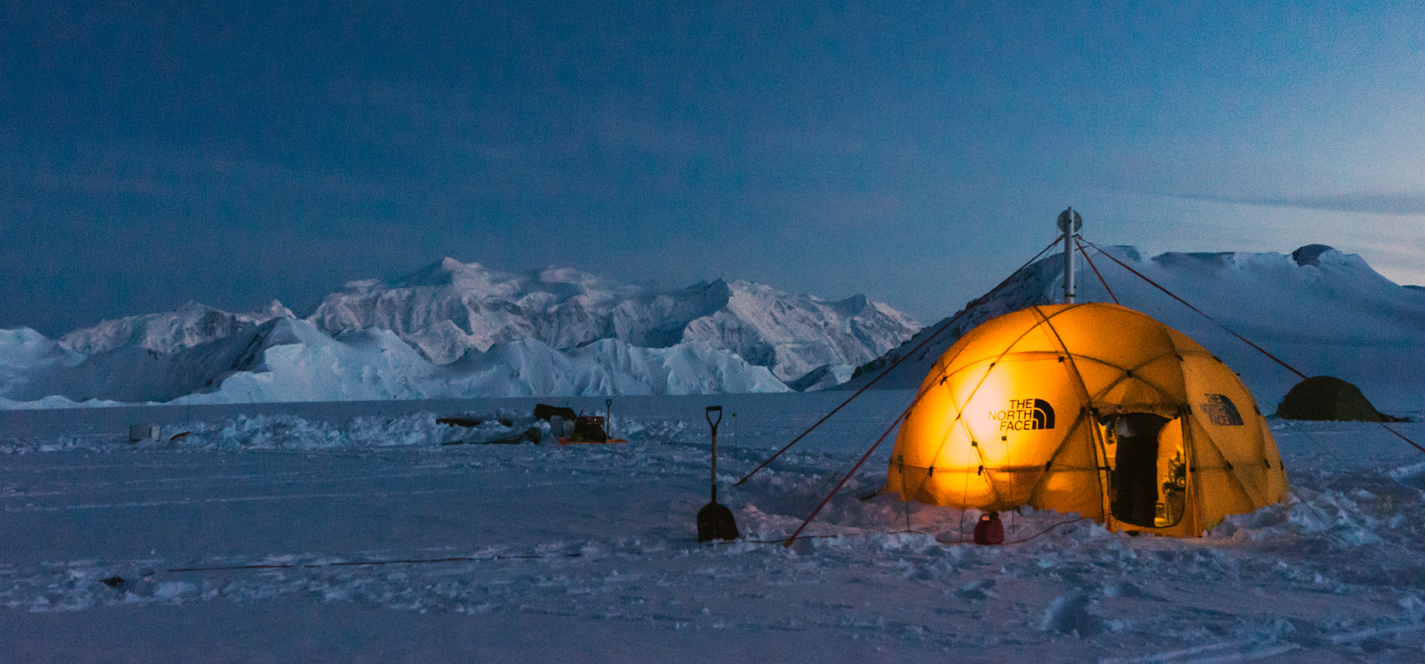
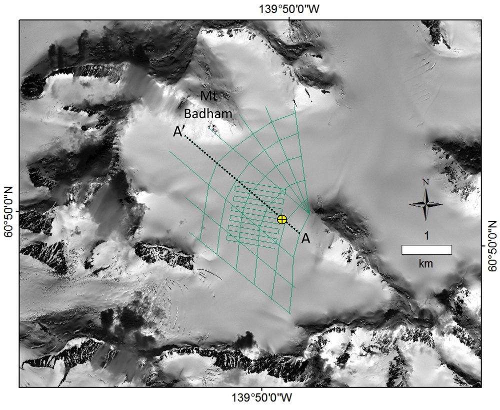
With funding from the National Science Foundation Paleo Perspectives on Climate Change (P2C2) program, we returned to the Eclipse Icefield in May 2016 to collect a variety of geophysical data. Our group included the principal investigators (K. Kreutz and S. Campbell, UMaine), a research scientist (D. Dixon, UMaine), three PhD students (S. Bernsen, UMaine; D. Winski, Dartmouth; D. Medrzycka, University of Ottawa), and two undergraduate students (J. Leavitt, UMaine; P. Saylor, Dartmouth). We worked with staff at the Kluane Lake Research Station (operated by the Arctic Institute of North America (AINA)) and Icefield Discovery to move us and all of our gear with a ski-equipped Helio Courier plane from Kluane Lake to Eclipse Icefield. This is probably the most spectacular 40-minute flight anywhere! After setting up camp, we started skiing lines on the icefield, collecting GPR and Global Positioning System (GPS) data. The GPR data gives a look inside the icefield itself – we can see internal layers (for example, the 1912 Katmai eruption) and the bedrock surface below the glacier. Then, by using all of the GPR and GPS data together, we can make maps of the surface elevation of the icefield, as well as the elevation of the bed surface below the glacier. Finally, three dimensional ice flow models will be used to accurately determine the age of ice at any particular depth, and to correct for the ice thinning that occurs deep in the glacier as the pressure from ice above increases.
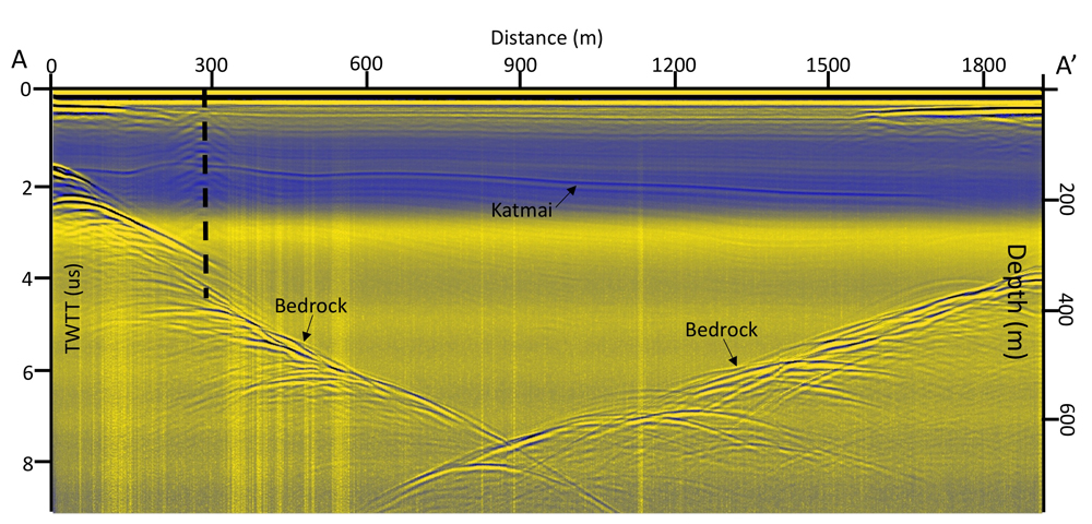
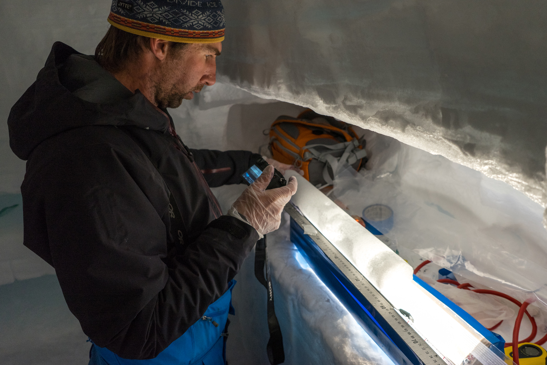
We also drilled a 65-meter long ice core, and built a science trench in the snow to cut individual samples from the ice core. Once all of the samples are analyzed, we will use the data to update the ice core collected in 2002 – essentially bringing the ice core record all the way up to the 2016 surface. One of the key findings from this season is that the mean annual temperature on the Eclipse Icefield has increased by ~4°C from 2002 to 2016, based on temperature measurements in the borehole – a rather substantial warming. Another key finding is that the ice is quite deep in the middle of the Eclipse Icefield (~700 meters). Based on what we know from the 2002 core, and from preliminary modeling of the ice flow, we believe that the ice near the bottom in the middle of the icefield should be 10,000 years old or more. And because the snow accumulation rate on Eclipse Icefield is quite high (around 4.5 meters of snow per year), the layers of annual snowfall are probably still preserved down near the bed. Our challenge now, in collaboration with the U.S. community of ice core scientists and engineers, is to figure out the technology needed to recover a 700-meter ice core from this site.
While we were working on the Eclipse Icefield this year, Mt. Logan was always looming in the background – a beautiful and impressive sight when the weather was clear. In 2017 we plan to collect the same type of GPR, GPS, and shallow ice core information from the ice core sites on Mt. Logan, and update those records and interpretations.
We would like to sincerely thank NSF, AINA and Kluane Lake staff (S. Williams, L. Goodwin, T. Bradley), and our collaborators at the University of Ottawa (L. Copland) for a wonderful and productive season.