GREENLAND IS MELTING. Over recent decades, this melt has accelerated and so have contributions from the Greenland Ice Sheet to global sea level. These mass losses are linked to warming both in the atmosphere and ocean. But just what are the connections between the ice sheet, the ocean, and the atmosphere; how have these evolved over time and space; and what happened before we had detailed satellite observations of changes across this region of the Arctic? These are all central questions our team of researchers from Woods Hole Oceanographic Institution (WHOI), Clark University, Wheaton College (MA), and the University of Washington is actively seeking to constrain.
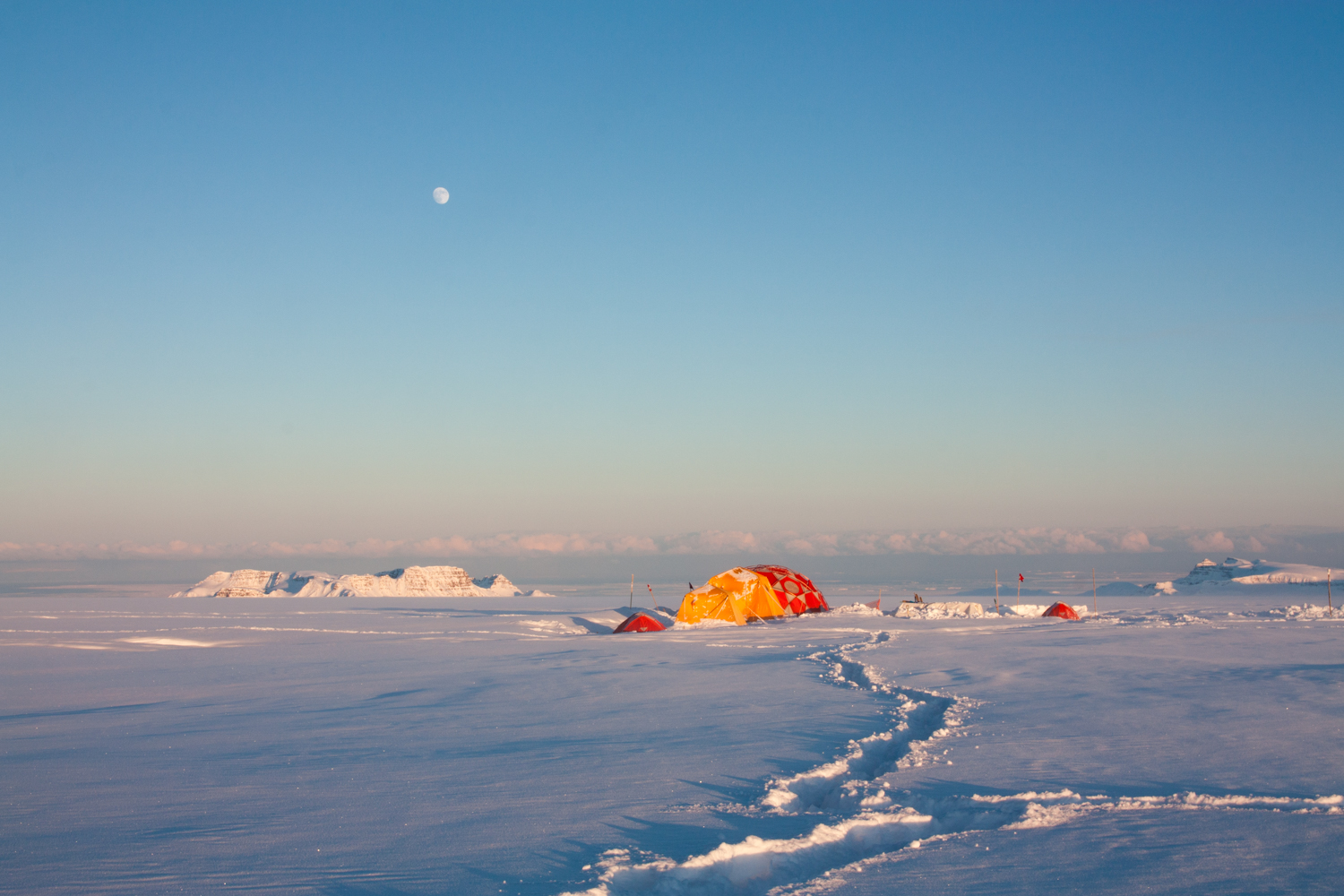
To begin to address these questions, fieldwork was just completed in Spring 2015 at several coastal locations in central west Greenland. To specifically focus on coastal climate and oceanic links to the Greenland Ice Sheet, three field sites were strategically identified: ice caps on Disko Island and Nuussuaq Peninsula (both located just west of the Greenland Ice Sheet), and a third location inland of these sites on the Greenland Ice Sheet proper. Drilling of firn and ice cores was undertaken by a team led by Sarah Das (Associate Scientist, WHOI), who was accompanied by myself, Luke Trusel (Postdoctoral Scholar, WHOI), as well as Matt Osman (Ph.D. Student, MIT-WHOI Joint Program) and expert driller, Mike Waszkiewicz (Ice Drilling Design and Operations; IDDO).
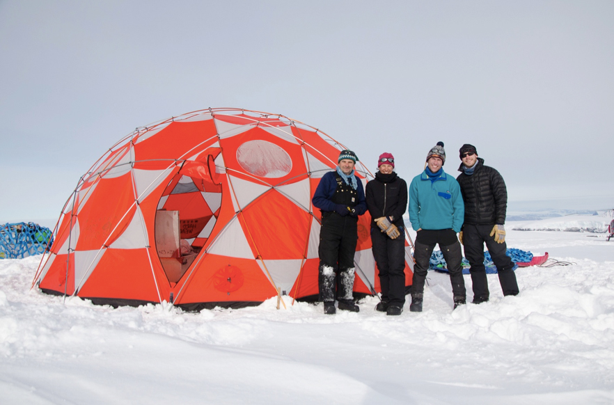
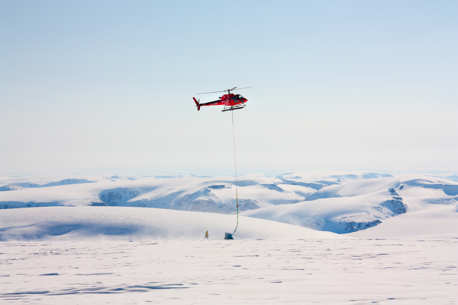
Firn and ice cores with target depths of around 100 meters were collected from all three sites, each of which presented unique logistical challenges. The inherently unpredictable weather of the remote field sites was a primary constraint on our fieldwork, and access to the sites was also governed by the suitability and availability of aircraft and helicopters. For instance, the small and highly crevassed Nuussuaq Peninsula ice cap site was only accessible by helicopter, whereas the inland distance of the ice sheet site required Twin Otter (a reliable ski-equipped aircraft) flights of about an hour and a half for field put in and pull out. Getting the weather to align with flight and fieldwork plans is a constant challenge working in these environments! After establishing field camps at each site, our team used IDDO's Eclipse Drill and recovered cores in about 1 meter sections. The use of a drilling tent proved to be extremely valuable, as we were able to drill in weather conditions otherwise unsuitable, therefore enabling the completion of all fieldwork roughly according to plan – not a small task!
After successful drilling at each site, the collected ice cores were then flown from the ice to the town of Kangerlussuaq, where they were kept cold in a freezer container. From Kangerlussuaq they are being promptly shipped to the National Ice Core Laboratory (NICL) for a core processing line (CPL) to commence in mid-June 2015. During the NICL CPL, we will create a digital archive of the ice cores using a digital line scanning system, record electrical conductivity profiles, and finally subsection the cores into discrete samples via precision sawing. From here, the samples will be shipped to the project's host institutions for further glaciochemical analyses.
After the fieldwork and NICL CPL, our team's science objectives begin in earnest. At the heart of these objectives is the critical and increasingly recognized influence of conditions at oceanic margins of ice sheets in governing ice sheet processes and overall health. Indeed, these marine impacts include effects on glacier advance and retreat, ice flow velocities, accumulation rates, and melt rates both at the ice sheet-ocean interface and across the ice sheet surface. Many of these processes are well documented today owing to satellite observations and climate models that can be driven by datasets incorporating observations. As we move back in time prior to the modern satellite era (that begins ~1978), however, this understanding is more poorly constrained. This increased uncertainty surrounds both our understanding of the state of the ice sheets and the surrounding oceans, and also the interactions between these important components of the cryosphere and climate systems.
Drilling ice cores such as those collected by our WHOI-led team can help address these uncertainties. To this end, researchers in this project will analyze the chemistry of the ice cores to determine ice dating (using parameters that vary seasonally, such as stable isotopes; as well as those varying more sporadically, such as known volcanic events). These analyses will allow us to reconstruct accumulation rate histories and develop additional proxies of past climate. As the ice cores were all obtained from locations of relatively high snow accumulation rates, proxy records with high temporal resolution (seasonally- to annually-resolved) will result, and these 100+ meter records are anticipated to span at least the last couple of centuries, including notably into the end of the Little Ice Age.
Of particular focus will be the analysis of isotopic and glaciochemical species that can be correlated with sea ice and sea surface temperature (SST) variability. For example methane sulfonic acid (or MSA) concentrations in ice result from a chain of events spanning back to photosynthesis via primary production at the nearby ocean surface. This primary productivity is in turn linked to the presence or absence of sea ice, and thus by measuring MSA in ice cores, regionally or locally specific proxies of past sea ice variability can be developed. Similarly, seasalts (e.g. Na and Cl) are concentrated on the surface of newly formed sea ice, and sea salt aerosols can thus be linked to periods of sea ice formation. To fully understand the ice core chemical records at each site, our group will examine the variability of the ice core-derived variables back in time in unison with satellite-observed sea ice and SST dynamics. After establishing the nature of these relationships over space and time, important records of past sea surface variability that predate the satellite era will be developed using only the novel ice core records. This will allow us to uniquely situate the detailed satellite record of recent Disko Bay and Davis Strait sea surface changes into a longer-term context.
An additional detailed record of past climate to be developed will be derived from the analysis of refrozen melt layers in the cores. The amount of melting each summer at the ice sheet surface is linked quite simply to the relative warmth of each summer: warmer summers produce more melt, colder summers produce little or no melt. At the coastal west Greenland sites of this project (all located within the glacier percolation zone) surface melt drains into the near-surface firn and then refreezes. By analyzing the amount of refrozen melt archived in the ice core using instruments such as the NICL imaging system, we can reconstruct a history of melt back in time. Combined with existing datasets and the glaciochemically-derived sea surface variability records, the melt history will provide important insights into the coupling between the ice sheet, the ocean surface, and the climate system over the last several hundred years. Furthermore, the dramatic acceleration of melt observed with satellites over the last several decades will be framed within a centennial-scale perspective.